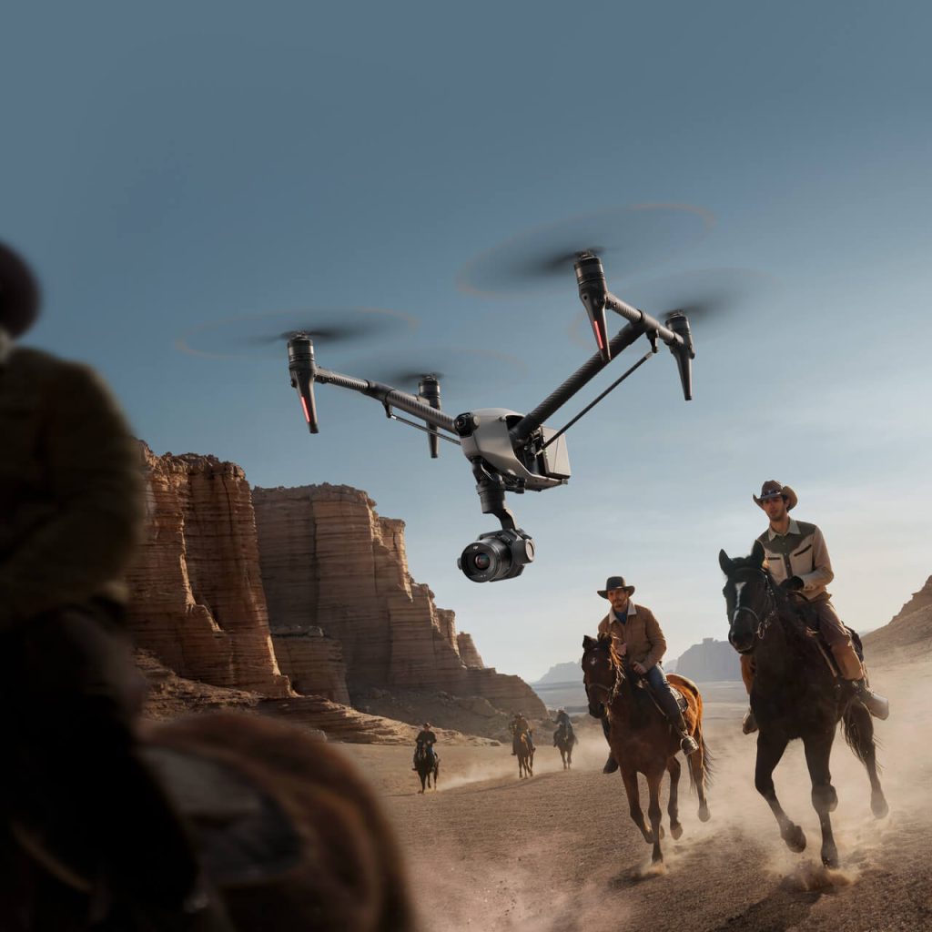
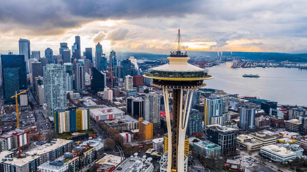
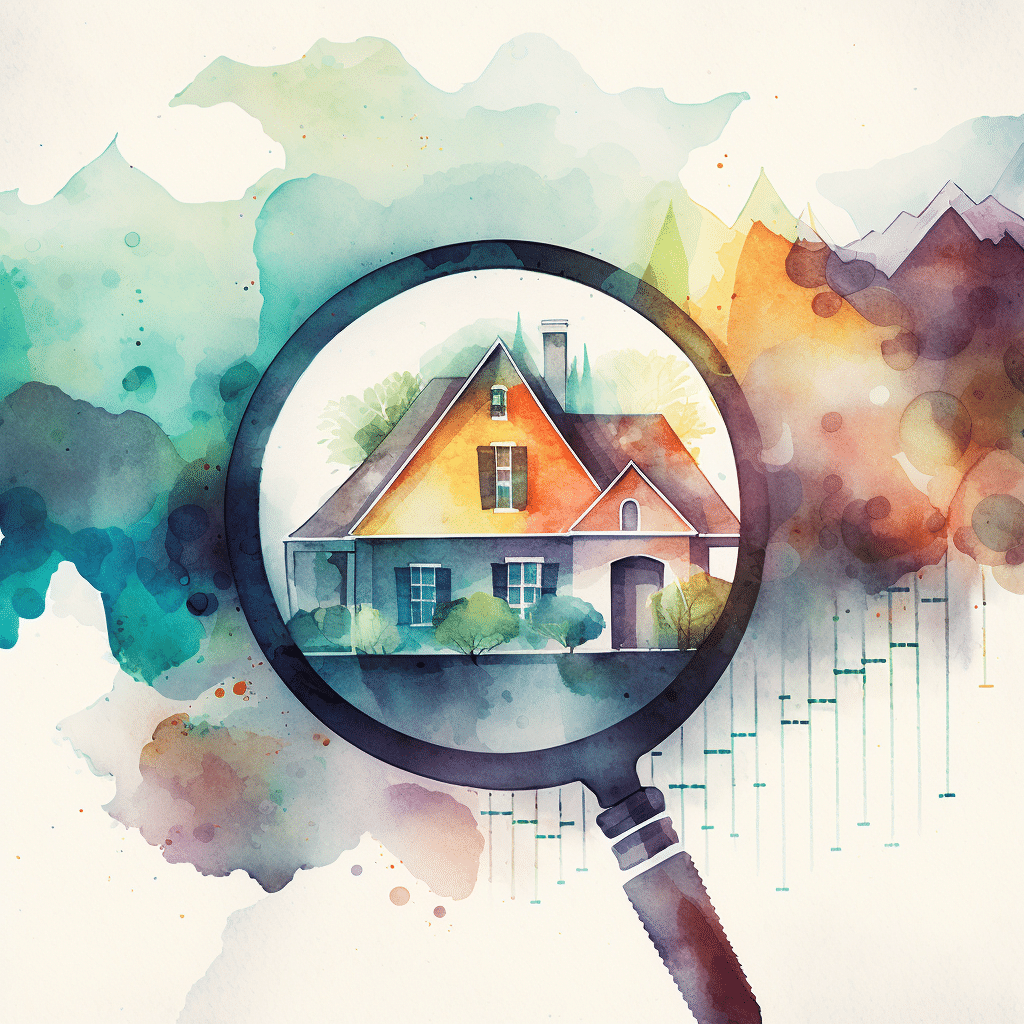
Drone inspections are transforming the way we approach routine and complex inspection tasks. The types of inspections can include cell towers, roofs, power lines, solar panels, and other infrastructure. The benefits of using drones for inspections include them being done faster, cheaper, safer, and will more comprehensive data. Whether you're a seasoned drone pilot or just got your Part 107 certification, this article is your springboard to a promising side hustle in the drone inspection industry.
Drone inspections refer to the use of unmanned aerial vehicles (UAVs) to conduct inspections of buildings, structures, and systems that are often difficult, dangerous, or impractical to access by human inspectors. This technology offers unparalleled advantages in terms of safety, efficiency, data accuracy, and cost-effectiveness, making it an increasingly popular choice across various sectors.
From examining the integrity of vast pipeline networks to conducting intricate roof inspections, drones are proving to be a game-changer in many industries. They provide invaluable insights and help mitigate risks, making drone inspection services a significant asset for businesses and governments alike.
The beauty of drone inspection services lies in their versatility. Below, we delve into some of the most common types of jobs, each with its unique benefits and challenges.
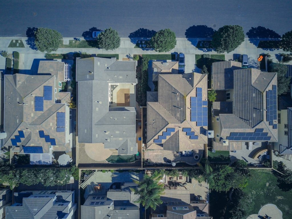
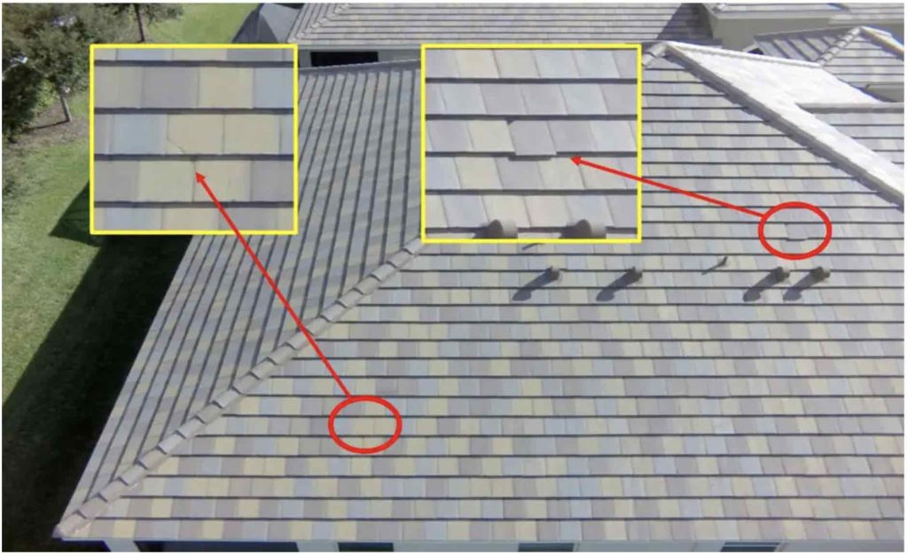
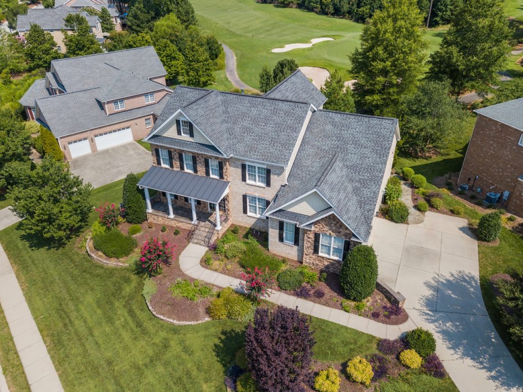
Roof inspections can be time-consuming and hazardous. However, drones can easily navigate these high structures. Drone can capture detailed images and footage that reveal issues like leaks, damage, and wear and tear. As a drone pilot, this means less time on ladders and more time flying your drone.
Drone roof inspections can include a variety of specific services:
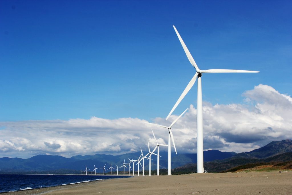
Wind turbines are tall, massive, and often located in remote areas. Inspecting them with drones not only improves safety but also increases efficiency, with drones able to complete an inspection in a fraction of the time it would take a human.
Drones with digital sensors can capture high-resolution images from large distances to optimize inspection times. This can also reduce the risks to the wind turbines from getting damaged by the drones from a collision.
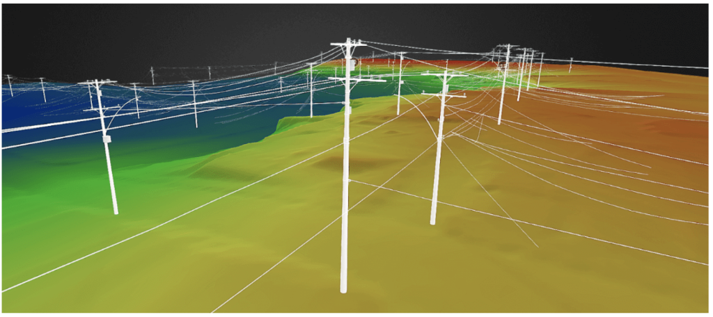
The inspection of power lines is a critical task to ensure the reliability of our power supply. Drones are an excellent tool for this job, providing a safe and efficient way to inspect these high-voltage structures.
Utilizing video, imagery, thermal, and even LiDAR, drones can capture data to help provide information such as:
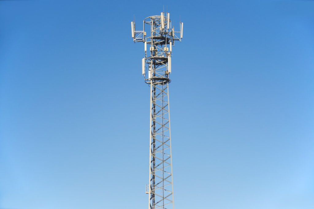
Cell tower inspections serve as a practical application of drones in the telecommunication industry. By using drones, detailed imagery and 3D mapping of cell towers can be obtained, replacing traditional manual inspections which often present significant challenges and risks.
Drone cell tower inspection services can lead to increases in operational efficiency, as drones can access difficult-to-reach areas without the need for extensive equipment or tower climbing. This not only reduces the time spent on inspections, but also cuts down on related costs.
Using drones for inspections enhances safety measures, as it significantly reduces human exposure to potentially hazardous situations. This includes radio frequency emissions and the physical dangers of climbing towers.
Lastly, the accurate data collected by drones can facilitate better predictive maintenance, contributing to the improved performance and lifespan of cell towers.
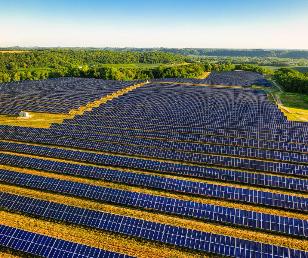
Drones equipped with thermal imaging cameras are a perfect match for inspecting solar panels. They can quickly and accurately identify malfunctioning cells or panels, allowing for targeted maintenance and increased efficiency.
Solar panels can be installed on roofs in urban areas, as well as larger solar farms. Regular inspections can identify issues that can cost thousands of dollars in missed production!
Insurance companies are increasingly using drones for inspections following claims or for risk assessment purposes. This not only expedites the claims process but also improves accuracy, ultimately leading to better customer service and cost savings.
Drones can be used for everything from a roof damage inspection, to other types of inspections of structures and even vehicles.
In the oil and gas industry, pipeline inspections are a critical task to prevent leaks and ensure safety. Drones make these inspections faster, safer, and more cost-effective, providing detailed imagery and data over large distances.
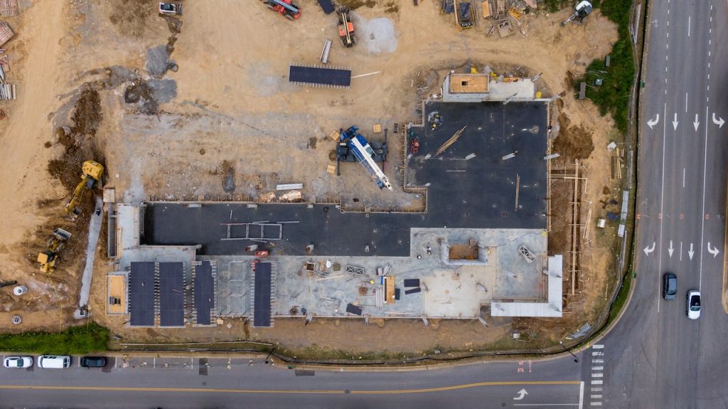
In the industrial sector, drones are used to inspect a wide variety of structures and equipment. They can access hard-to-reach areas, detect problems early, and help industries like manufacturing, construction, and oil & gas to operate more efficiently and safely. This can include exterior and interior scans.
Think about inspecting cranes and other equipment that are difficult to inspect but require regular maintenance.
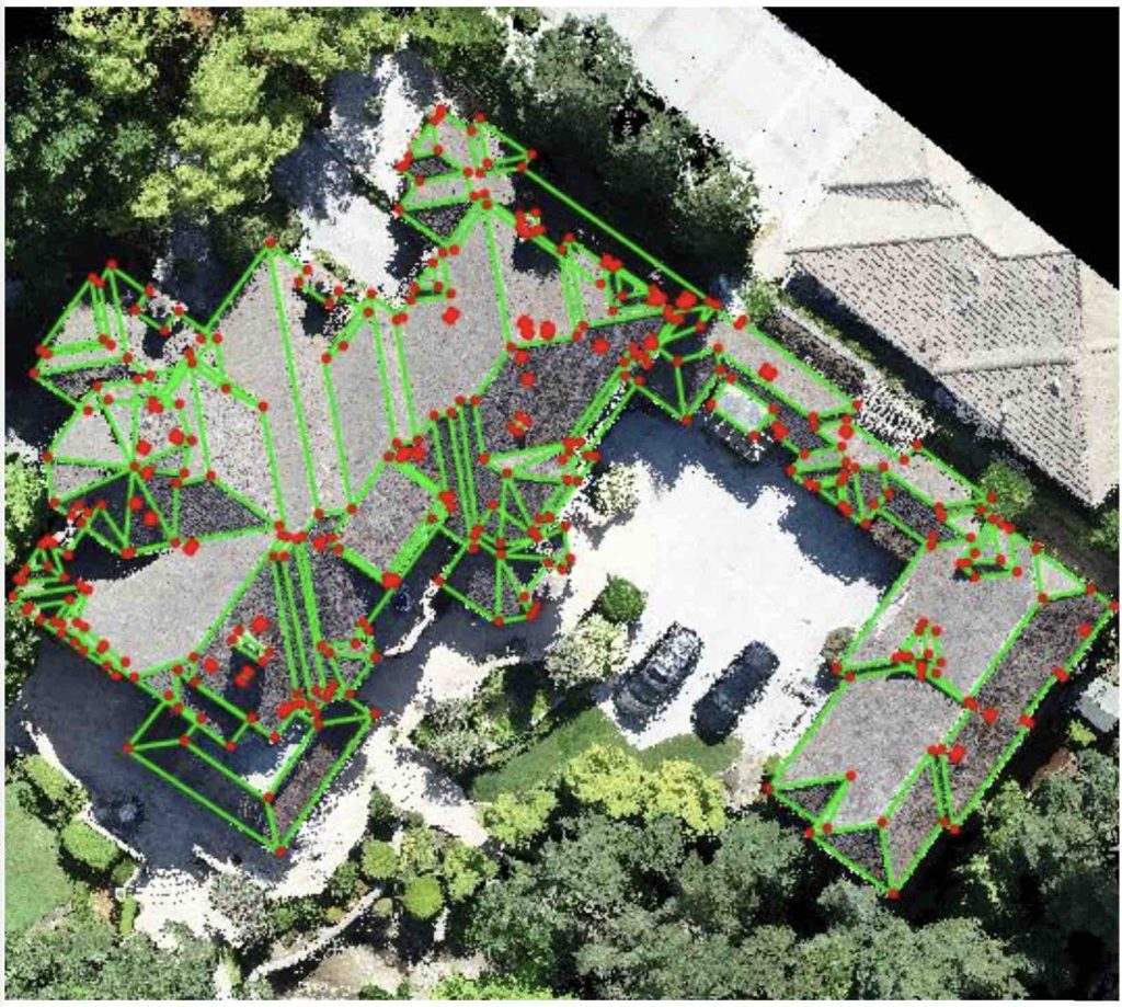
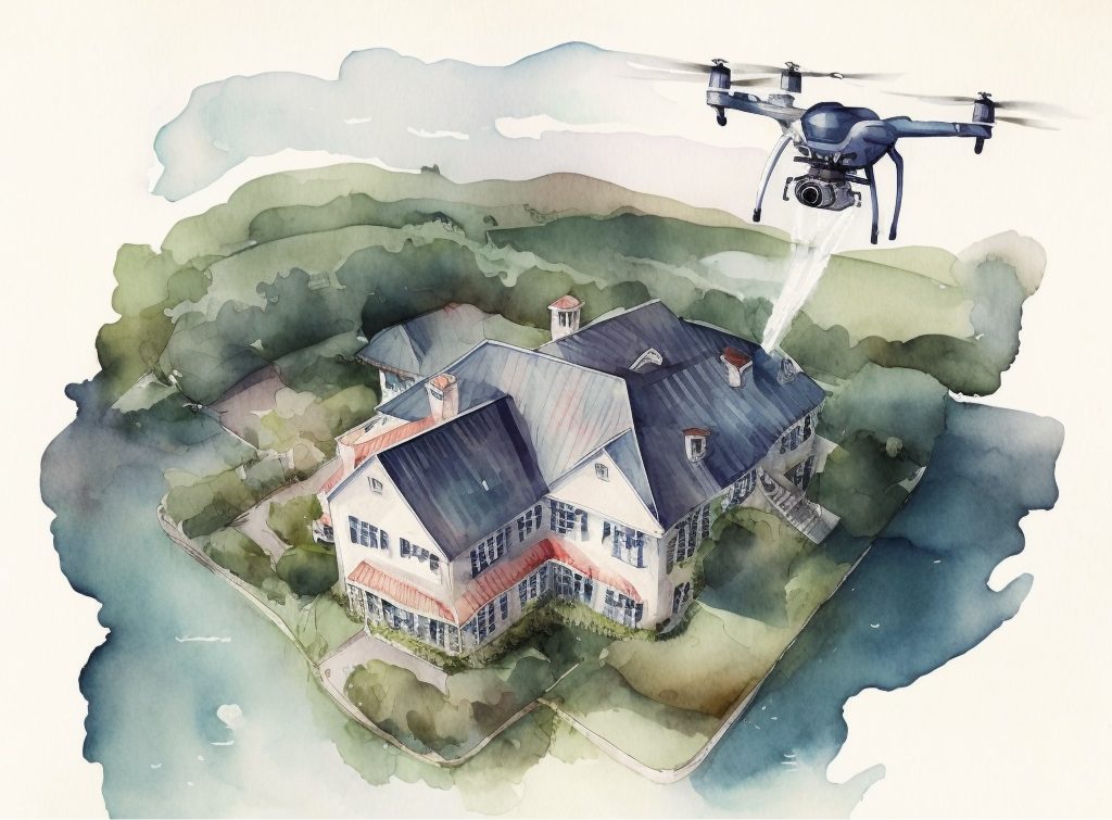
Drone technology plays a key role in inspecting essential infrastructure such as bridges, dams, and walls. Drones capture high-quality images and create detailed 3D models, providing a thorough inspection compared to traditional methods.
Drone inspections increase operational efficiency, as they can easily navigate hard-to-reach areas, reducing the need for costly scaffolding or other equipment. Safety is enhanced as drones eliminate the need for personnel to access dangerous locations. Additionally, drones collect accurate data, aiding in predictive maintenance and extending the lifespan of structures. For drone pilots, offering drone inspections can significantly contribute to the advancement of infrastructure management.

If you're keen on leveraging your Part 107 certification and drone piloting skills, drone inspection jobs offer a promising avenue. A typical job involves flying a drone to collect visual data, interpreting the data, and compiling an inspection report. Depending on the job, you may need additional skills such as understanding specific inspection protocols, operating advanced drone technology, or using specialized software for data analysis.
To further enhance your service provision, consider gaining additional certifications or training specific to the inspection services you're interested in. For example, a thermal imaging certification can be beneficial for solar or roof inspections.
As a drone pilot looking to offer drone inspection services, it's crucial to understand what clients look for in a service provider. They'll consider factors like the drone operator's experience and qualifications, the quality and accuracy of the data collected, the speed of service, and, of course, cost.
If you're on the other side of the coin and looking for drone inspection services, it's essential to choose a service near your location to ensure quick response times and lower travel costs. It also helps to read reviews or seek recommendations to find a trusted and reliable service.
The drone inspection industry is continuously evolving, with emerging trends like automated drone inspection services and autonomous drone operations promising to reshape the landscape further. Technological advancements in drone inspection software, analytics, and data management are set to further enhance the speed, accuracy, and value of the services provided.
As a drone pilot, staying informed about these trends and adapting your skills and services accordingly can help you stay ahead of the curve and seize new opportunities.
A drone inspection service involves using drones to inspect structures or systems that are hard-to-reach, dangerous, or inconvenient for human inspectors. It offers numerous advantages, including improved safety, efficiency, and cost-effectiveness.
The cost of a drone inspection service varies depending on factors such as the complexity of the inspection, the size of the area to be inspected, and the specific industry. It's best to get a quote from several service providers for an accurate estimate.
While a Part 107 certification is the primary requirement to provide drone inspection services commercially in the U.S., additional certifications or training may be beneficial depending on the type of inspections you intend to perform.
There are many types of drone inspection services, including roof, wind turbine, power line, industrial, solar, insurance, and pipeline inspections.
To start a drone inspection service, you'll need a Part 107 certification, a suitable drone, and the necessary skills to perform inspections and interpret the data collected. It's also crucial to understand the specific inspection needs of your target market and to comply with all relevant regulations and insurance requirements.
Drone inspection services are revolutionizing various industries, bringing unprecedented benefits in terms of safety, efficiency, and cost-effectiveness. For drone pilots with a Part 107 certification, this presents a fantastic opportunity to start a rewarding side hustle or full-time career in drone inspections.
But the journey doesn't end here. The future of drone inspections promises even more growth and innovation, with trends like automation, autonomy, and advanced data management set to redefine the industry landscape. As a drone pilot, embracing these trends and continuously honing your skills can help you stay competitive and seize new opportunities.
We hope you found this comprehensive guide to drone inspection services insightful and inspiring. If you have any questions, comments, or experiences to share, we'd love to hear from you. Leave a comment below, or reach out to us directly. And if you found this article useful, don't forget to share it with your fellow drone enthusiasts!
Interested in more drone-related content? Subscribe to our newsletter for the latest news, tips, and insights from the drone world. Let's keep exploring the skies together!
In today's competitive real estate market and online listings, capturing the essence of a property is more important than ever. Enter real estate drone video, the game-changing tool that's enhancing property visualization and transforming the way we market and sell homes. For drone pilots looking to start a drone real estate business or make money with drones, video is essential part of that equation.
Drone videos in real estate aren't just a passing trend; they're a powerful method for showcasing properties, providing unique perspectives, and increasing property appeal. But how did we get here, and what's driving this shift in real estate marketing? Let's take a closer look.
The use of drone real estate video has skyrocketed in recent years, and for good reason. The introduction of affordable, easy-to-use drones has made aerial photography and videography more accessible than ever.
Once the exclusive domain of high-end properties, drone videos are now commonplace in real estate listings of all sizes and price ranges. Current trends suggest that real estate drone videos will continue to grow in popularity, as buyers and sellers alike recognize their power to make properties stand out from the crowd.
According to Sold By Air, over 83% of homeowners prefer to work with an agent that uses drones.
Drone videos bring a wealth of benefits to real estate marketing. They enhance property visualization by providing unique, bird’s-eye views that traditional ground-level photos can't capture. This not only increases property appeal but also saves time and resources by giving potential buyers a comprehensive view of the property before they even step foot on it.
Beyond showcasing the property itself, drone footage can highlight the surrounding area, showcasing nearby amenities and giving buyers a sense of the neighborhood. This comprehensive approach to property visualization can be a significant factor in attracting interest and closing sales.
Creating a compelling real estate drone video isn't just about flying a drone and pressing record. It requires careful planning, the right equipment, and an understanding of FAA regulations.
From choosing a drone with the right capabilities to learning the best practices for shooting and editing, there's a lot to consider. Of course, legal considerations are also vital, so understanding and adhering to FAA regulations for drone operators is crucial.
Learning from success is one of the best ways to improve your own real estate drone videography. Detailed case studies of top real estate drone videos can provide valuable insights into what works and why.
From the initial planning and shooting stages to the editing and post-production process, these case studies can guide you in creating your own successful real estate drone videos.
Below is an example of a commercial real estate drone video with animations and details that would interest a prospective buyer or tenant.
For residential properties, we'll typically see drones used to supplement ground based video. This is typical for standard and luxury properties.
As technology continues to evolve, the future of real estate drone videos looks bright. Predicted trends suggest we'll see even more advancements in technology, such as artificial intelligence, virtual and augmented reality, and 5G connectivity. These emerging technologies are poised to redefine how drone video footage is captured and experienced. AI algorithms could optimize drone video footage, while VR and AR could create immersive video experiences, and 5G could enable faster, more reliable video transmission.
As drones become more advanced, regulations are also expected to evolve, particularly regarding drones operating in new environments. For example, we may see new regulations for drone usage in urban areas or specific applications such as delivery or inspection. Drone operators should stay informed of these changes and be prepared to obtain additional licenses or certifications as needed.
The future may also bring new applications for drone videography. Beyond real estate, drones may be used for inspection and surveillance purposes, scientific research, environmental monitoring, and even entertainment. Imagine drones providing dynamic perspectives at live sporting events, concerts, or tourist attractions, enhancing the experience for audiences and visitors alike.
What to charge for real estate drone video?
The cost of real estate drone videos can vary depending on the complexity of the shoot, the length of the finished video, and the specific requirements of the client. On average, prices can range from $100 to $500 per hour. Real estate drone photography can be priced very similarly.
How do you take drone videos for real estate?
Taking drone videos for real estate involves several steps, including planning the shoot, setting up the drone, capturing the footage, and editing the video. It's important to consider the property's best features and how to highlight them from an aerial perspective.
What is the best time of day for real estate drone photos?
The best time of day for real estate drone photos is usually during the golden hours. Golden hours are typically short periods after sunrise and before sunset. During these times, the lighting is soft and warm, which can enhance the property's appearance.
What is the best drone for real estate photos and videos?
The best drone is the one you already have! And if you don't already own one, there any many inexpensive options that provide a lot of bang for the buck!
Does drone footage help sell a house?
Yes, drone footage can significantly help sell a house. It provides potential buyers with a unique perspective of the property, showcasing the home's layout, the size of the land, and the surrounding area. This can make the property more appealing and help it stand out in the market.
How high do you fly when doing aerial drone videography or photography for real estate?
The height at which you fly a drone for real estate videography or photography can vary depending on the specific shot you're trying to achieve. In general you will be flying at altitudes between 20 feet to 200 feet above ground level. However, it's important to always follow local regulations and guidelines regarding drone flight altitudes. In many places, the maximum allowed altitude is 400 feet above ground level.
How can you get clients?
Getting real estate clients is an important part of building up your real estate drone business. There are many ways to do this, including leveraging your network, as well as through cold outreach (calls and emails).
In conclusion, real estate drone videos have revolutionized the way properties are marketed and sold. By offering unique perspectives, increasing property appeal, and providing comprehensive property visualization, drone videos are an invaluable tool in modern real estate marketing.
If you're a drone pilot looking to diversify your skills and income, creating real estate drone videos could be an excellent opportunity. With the right knowledge, equipment, and approach, you can create stunning videos that help properties shine and sellers succeed.
Ready to take your drone piloting to new heights? Explore our other resources on drone videography, join our community of drone enthusiasts, and don’t forget to sign up for our newsletter for the latest trends and tips. The sky's the limit!
Do you have your Part 107 certification and are ready to start earning money with your drone? Real estate photography is one of the most lucrative sectors for drone pilots, and it's crucial to choose the right equipment to excel in this field. In this article, we'll explore the best drone for real estate photography, giving you all the information you need to make an informed decision and kick-start your aerial side hustle. Let's dive in!
If you're just getting started with droning commercially, don't let the fact that you don't own a "premium" drone affect putting yourself out there to start your side hustle! Many beginners will worry that the drone they already own is not good enough to selling images and videos from, which isn't true. The majority of the challenges a pilot will face when starting a drone real estate photography business revolve around reaching out to clients, not the quality of the photos or videos.
If you own a drone that shoots a minimum of 12 megapixel photos and 1080p video, that's all you'll need to get started!
Below is a list of drones at several price points and use cases. Unquestionably, if you are a drone hobbyist learning about starting your own drone business, or seasoned pro looking for the next best drone for the job, this list has something for everyone:
We're a team of active drone business owners who cut through the fluff and focus on real world applications for real estate clients. Overall, most reviews you'll read online focus on the features of the drone, rather than how it directly relates to your work photographing a property. Read the important qualities through the lens of real estate drone photography.
Firstly, the quality an an aerial image is directly correlated to the size of the image sensor. The bigger the sensor, the better the quality of the imagery. The megapixel count is important for a baseline understanding of the image quality, however the camera sensor is the deciding factor is how good those images look.
Aerial photography is the primary focus for drone real estate businesses, although aerial video plays an important part. Some real estate agents like to combine drone video of real estate with a house walk-through video to provide a complete picture of a property. Video quality higher than 1080p is ideal because viewers are able to see the details of the home. Most drones are capable of 4k footage which is preferred to shoot video in because of the higher quality, as well as ability to crop and shift as needed.
Thirdly, flight time is important when selecting a drone because it will determine how many photos and videos you'll be able to capture per battery. Generally speaking, you can capture all the photo angles within a single 8-10 minute flight. The longer the battery life, the more opportunities you'll have on a single flight to capture everything that's needed. It is recommended to have a least 2 batteries for real estate photo shoots.
DJI manufactures the most popular drones in the world. All DJI drones have nearly identical controls, so it is easy to transition to any of their drones once you've mastered one. DJI drones are also the easiest to use right out of the box, saving you valuable time.
Many pilots prefer to capture aerial imagery and video manually, however there are specific types of angles and shots that intelligent and autonomous flight modes can nail effortlessly. These include:
A reliable drone that just works when you arrive to a real estate property to shoot is so important. First of all, a reliable drone makes you look more professional because all the equipment is working as it should. It also keeps you focused on flying the drone and capturing images and video rather than troubleshooting.
Overview: The DJI Mavic 3 Classic is a workhorse drone that combines stunning photo and video capture with smart flight modes, and incredible flight time. This drone far exceeds everything you will need to get started with aerial photography. It sits in a spot of a mid-tier cost (sub $2000) while providing near best in class specs at nearly level. This is our recommended drone once you've established your business and are expanding and scaling.
Specs:
Pros:
Cons:
DroneTribe Real Estate Rating: 10/10
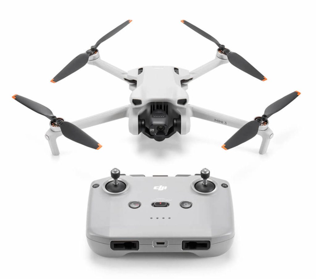
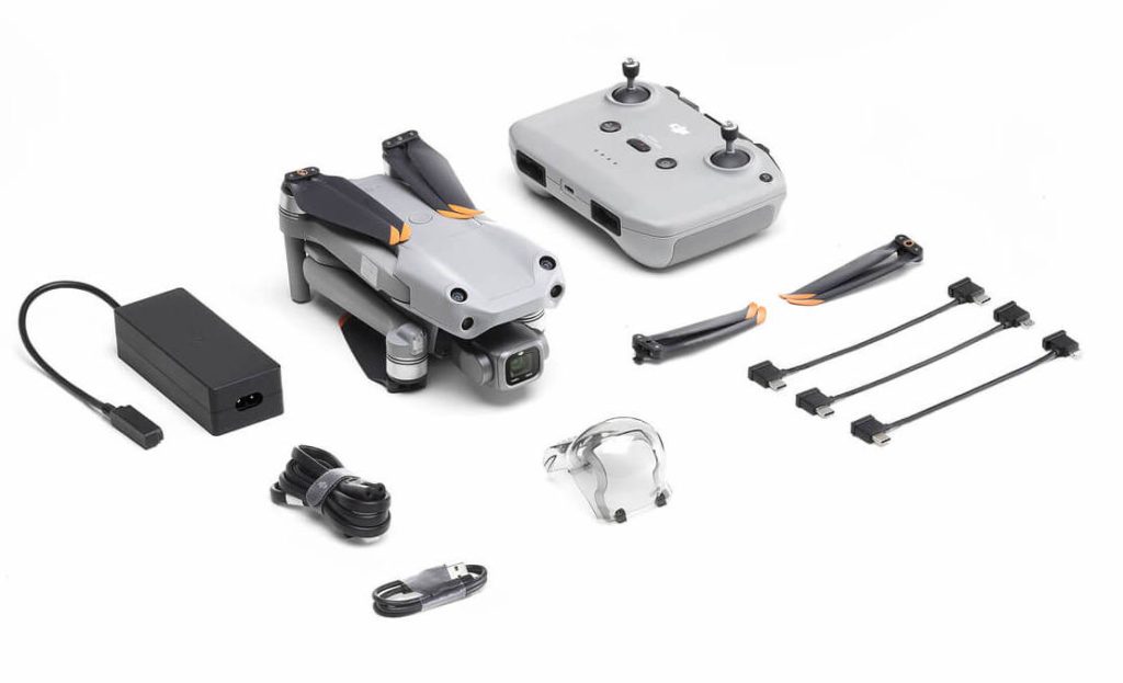
Overview: The DJI Mini 3 is the best budget drone on the market for drone real estate photography. It combines all the features you would expect from a DJI drone, wrapping it in a small and light frame factor, and topping it off with a great camera sensor and video capabilities. This is the perfect drone for those just starting a drone business or are on a strict budget.
Specs:
Pros:
Cons:
DroneTribe Real Estate Rating: 8/10
Overview: The DJI Mavic Air 2S the best drone on the market for beginners starting out with drone real estate photography. It combines all the features you would expect from a DJI drone, wrapping it in a small and light frame factor, and topping it off with an incredible camera sensor and video capabilities. This drone provides more advanced features for real estate photography that allows beginners to grow into the drone.
Specs:
Pros:
Cons:
DroneTribe Real Estate Rating: 9/10
Overview: The DJI Inspire 3 is a beast of a cinematic and aerial photography drone. However, it's more drone than the majority of pilots need for drone real estate photography, however it's worth going over the details as something to aspire to.
Specs:
Pros:
Cons:
DroneTribe Real Estate Rating: 10/10
Selecting the best drone for real estate photography is crucial for success in this competitive field. The options we've discussed in this article offer a range of capabilities and price points, ensuring there's a drone to suit every pilot's needs.
Overall, whether you're just starting out or are a seasoned professional, investing in the right drone will enable you to capture stunning aerial imagery and grow your real estate photography side hustle. So go ahead and make your choice, and get ready to soar to new heights in your career!
If you're looking for more advice on drones and the real estate
industry, check out our comprehensive guide starting a drone real estate photography business. This resource will provide you with tips, tricks, and best practices to ensure you're well-prepared for this exciting field.
Did you find this article helpful? Don't forget to share it with fellow drone pilots and real estate enthusiasts! And if you have any questions or comments, feel free to leave them in the comments section below. We'd love to hear your thoughts and experiences with these fantastic drones.
Are you a Part 107 certified drone pilot looking to turn your passion for flying into a lucrative side hustle? Real estate drone photography is an excellent opportunity to showcase your skills and make money with drones. But, how do you price your services competitively while still maximizing your earnings? In this comprehensive guide, we'll explore real estate drone photography pricing and provide valuable strategies for determining your rates.
Let's dive in!
When setting your drone photography pricing rates, consider the following factors:
The time spent traveling to and from the property should be factored into your pricing. Expect longer travel times to increase your overall costs. When starting out, plan to focus on a specific town or city within 10-15 miles to minimize your drive time. As time goes on, you can easily expand the area that you serve.
Another point to consider is the mileage reimbursement rate if you drive your own vehicle. This rate takes into account wear and tear on your vehicle, and well as gas. The rate changes annually and is currently $0.655 per mile. If your job was a 5 mile drive each way (10 miles total), this would total $6.55 of "costs" based on that rate.
Investing in high-quality drone equipment is essential for capturing stunning aerial visuals. Include your drone, batteries, and other necessary peripherals in your pricing calculations. Most drone pilots don't include their equipment costs in their pricing.
For all equipment, there is a useable lifespan. A typical depreciation schedule for how long the equipment is still useful is below:
A general rule of thumb on how to account for these equipment costs would be to take this schedule and create a "monthly" cost. Then divide by the number of jobs per month.
The best real estate drone should last 2-3 years, but could last much longer depending on the manufacturer and your maintenance schedule.
Consider the value of the home you're photographing. Higher-priced properties often demand more sophisticated shots, which can justify a higher price for your services. A higher priced home may also require a more demanding schedule and type or style of edited photos.
Real estate agents earn a higher commission if they sell a $1,000,000 house than a $250,000 house which is important to keep in mind.
Specify the number and type of deliverables (e.g., photos, videos, 3D renderings) you will provide to your client. Some projects require only a handful of aerial photos, unedited. Other projects are a full service which include dozens of aerial photos carefully edited, along with an edited and produced video.
Aerial photos are lightweight and can be quick to deliver, while video can have large file sizes which will slow down the process. When the client requires anything more than just photos, make sure to keep this into account.
Ensure you're compensated fairly for the time you spend planning, executing, and editing your projects. There are multiple aspects to your time that you may not realize:
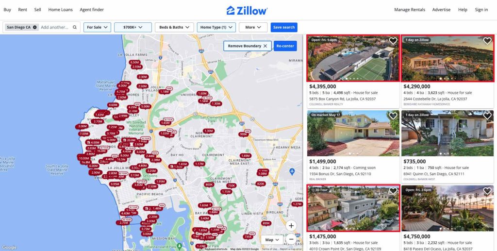
Research your local market and drone real estate photography pricing trends to remain competitive within your geographic area. To research the market, take a look at the listing websites (Zillow, Redfin, Realtor.com and your local MLS website) in the area you have chosen to offer your aerial photography services.
Review 20-30 single family home properties in your area to get an idea of how aerial photos and videos are being used. You may find that every listing over a certain price point (ie. $700,000) includes them, or that listings near certain features (mountains, oceans, lakes etc). This type of review will also show you how real estate agents in your area are using aerial photos. This use ranges from no aerial photos, to only 3-4, to over a dozen.
On your review, you'll also see if the aerial photos are edited and labeled to include items like property lines, neighborhood or nearby features, or other property details.
All of these items are data points to help determine how to market and price your services.
When first starting, offer a discount and low price to attract clients and build your portfolio. Providing high-quality services for $75-150 per property is a great starting point if you don't have any examples of your work. Remember, you might initially earn a lower hourly rate while establishing your business, but as you refine your processes and enhance your skills, you'll find ways to maximize your efficiency and earnings.
As you get more examples of work, clients, and confidence offering and delivering your aerial services, gradually increase your prices. Some real estate agents are very price sensitive, while others realize that great and reliable aerial images will help sell their listings faster, which will help them get paid their commission faster. You can also include upsells to increase your earnings from just a standard package of aerial photos.
Another important thing to remember, is that the more leads or potential customers you have, the less price sensitive you can be. Learning how to get leads and market your drone real estate services is huge!
Expand your offerings to generate more revenue by upselling additional services:
Charge extra for retouching and enhancing your aerial images using professional editing software. Enhancing your aerial images may include applying filters, adjusting the saturation/contract/hue, or matching the style of the photos the ground based photographer used.
Retouching your aerial images might include removing items like cars, people, or even you as the drone pilot from the image.
Editing software like Adobe Lightroom and Canva are great options for these types of enhancements and touchups.
Offer to add property labels, overlays, or annotations to images for an additional fee. These can enhance the listing and provide additional context for a potential home buyer. These types of labels can be added to your aerial photos in software like Adobe Photoshop and Canva.
Create dynamic aerial real estate drone videos showcasing property features or providing virtual tours. Many listings include a virtual walk-through of the property, and aerial video is an important aspect to understanding the location!
Offer premium expedited delivery services for clients that require quick project turnarounds. Typically offering your services with a specific delivery window, such as 3-5 days after capturing photos is standard. However, in some cases agents need the photos within 24 hours before a listing goes live. Consider offering this expedited service as an upsell.
Approach your pricing strategy as if your services were tangible products. Focus on deliverables and avoid complex contracts.
Typically for aerial photography for real estate, no contracts or proposals are needed because of the price points of the service. A simple email with the scope typically will suffice. In the email, including the number of photos, style of photo, and photo enhancements or labels, and the cost is important.
Develop a straightforward invoicing process to collect payment from clients. Send invoices upon project completion, and make sure they include an easy-to-use credit card payment link. Most agents would prefer the ability to submit payment with a credit or debit card as opposed to a check or cash. Offering the ability to pay by card will typically mean you get paid faster.
On invoices, some common payment terms you can specify are payment due on receipt, Net 14 or Net 30. Payment due on receipt is very common due to the low price point (ie. <$1000) for the services.
After you've established your service offerings, delivered several projects, and feel confident about your service, it's time to develop a true pricing structure.
All those items included in the beginning of this article including drive time and equipment costs can now be incorporated into your pricing. This will typically see you increase prices on each job until you're regularly in the $200-$400 range.
Ready to jumpstart your real estate drone photography business? Start by honing your flying and photography skills, research pricing trends in your area, and establish your pricing strategy based on factors like drive time, equipment costs, and market demand. Don't forget to consider upselling opportunities and streamline your invoicing process. Before you know it, you'll be capturing breathtaking property visuals while earning a lucrative side income. Good luck, and happy flying!
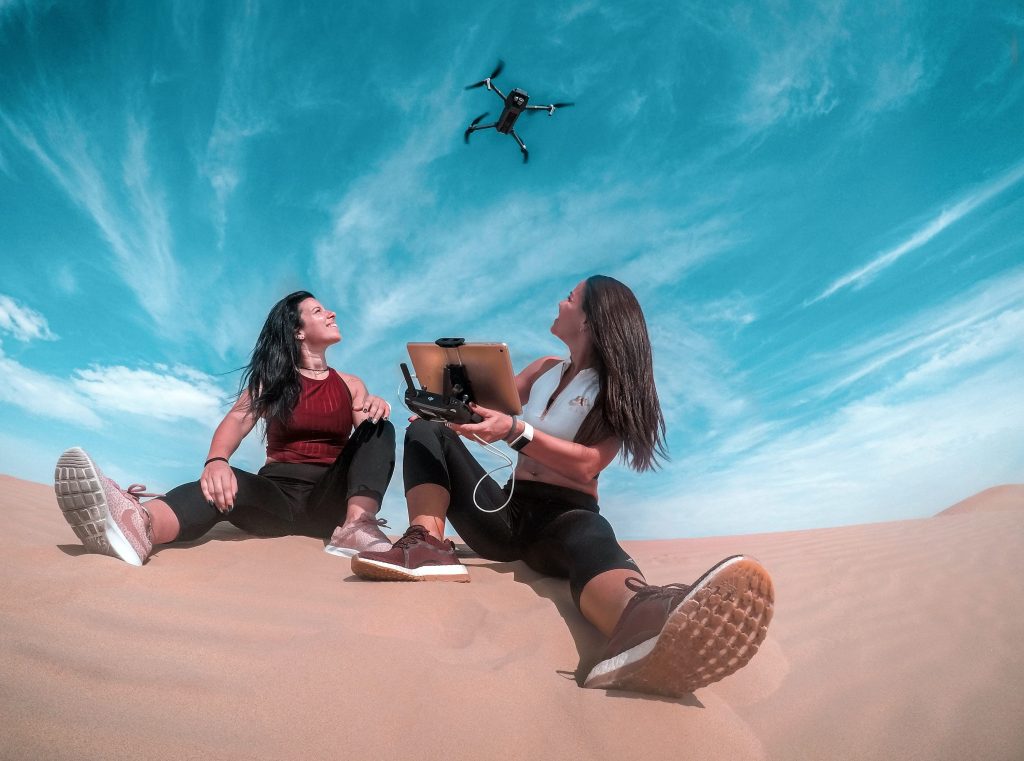
As a drone pilot with your part 107 certification, you've mastered the art of flight. But have you ever wondered how to turn that skill into a profitable side hustle? In this blog post, we'll explore 10 specific and actionable ways to make money with drones. So, buckle up and let's take this journey together!
Drones offer an impressive array of aerial capabilities, and as a drone pilot, you can tap into lucrative opportunities across various industries with a significant market demand. There are several key reasons to consider monetizing your hobby:
Before you jump headfirst into the world of professional drone piloting, there are several important factors to consider and prepare to meet legal requirements and client expectations:
Unleashing your creativity from the skies can be a lucrative venture. Stunning aerial photographs can be sold as stock photos on platforms like Shutterstock, Adobe Stock, Storyblocks , or directly to clients who value a unique perspective.
The process of selling stock aerial photos involves identifying specific categories that are selling well and doing more of the same. These include landscapes, cityscapes, infrastructure and industrial sites, seascapes, and agricultural farmland.
You can consider niche markets like golf courses, wedding, resorts, or marketing agencies may need aerial shots for marketing purposes. A single session could net you a few hundred dollars, making it a fantastic way to make money with drones.
Aerial videography is another exciting avenue to explore. With your drone, you can offer services to film events such as weddings, concerts, and sports games. The bird's eye view provides a unique perspective that can make these events even more memorable.
Outdoor and destination weddings are always on the lookout for unique ways to capture the event. Offering aerial videography can make their special day unforgettable. A well-executed wedding video can earn you over a thousand dollars.
Alternatively, consider creating a series of videos showcasing your local city or area. You can upload these to YouTube and monetize them through ad revenue. City reels on YouTube can be thought of as a lead generation tool. Remember, consistent content and a unique angle on familiar sights can quickly build up a dedicated following. There is a demand for local footage that can be used for anything from real estate, marketing, or other creators.
Drone real estate photography is a great niche to service and a simple way to make money with drones. Startup costs are slim for drone real estate photography. There is a huge demand of real estate agents needing of unique and attractive ways to market their properties. Offering drone services to capture aerial images and videos of properties can help them sell faster and for higher prices. Nearly all consumers browse homes online and use the pictures to determine how interested they are in a house. According to Zillow, homes with aerial images sold 68% faster than homes with standard images.
Drone mapping is a rapidly growing field with many applications. To create a drone map, the drone flies autonomously over a project site and takes photos at defined intervals. These photos are then uploaded into drone mapping software that will "stitch" them together, creating what is called an orthomosaic image. An orthomosaic image ("ortho" for short) provides numerous types of other outputs such as 3D site models. Drone mapping has a wide variety of use cases and is a very good way to make money with drones!
Drones offer a safe and efficient way to inspect structures that would be dangerous or difficult for humans to access. These can include bridges, power lines, wind turbines, and more. Offering your services to local government agencies or companies could turn into a steady stream of work.
Drone inspections typically include high resolution imagery or video. They can also include a variety of other sensors. Aerial inspections can be a very lucrative and recurring service and method of how to make money with your drone.
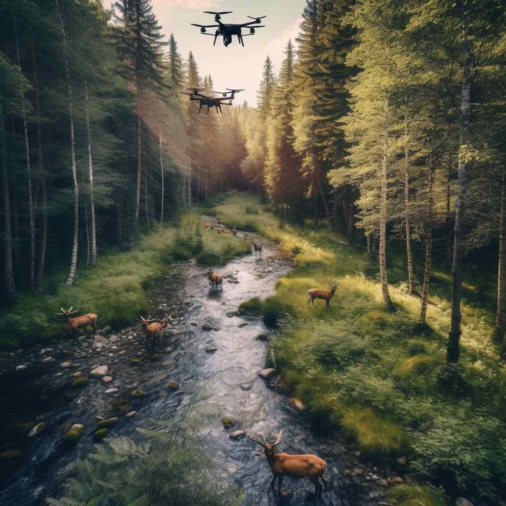
As a drone pilot, you have the power to make a significant impact on environmental conservation efforts. Drones can be used to monitor wildlife, track illegal activities like poaching, or assess environmental damage. This information can provide invaluable insights to conservation groups, scientists, or government agencies. While this might not be the most profitable avenue, it's certainly rewarding and contributes to a larger cause.
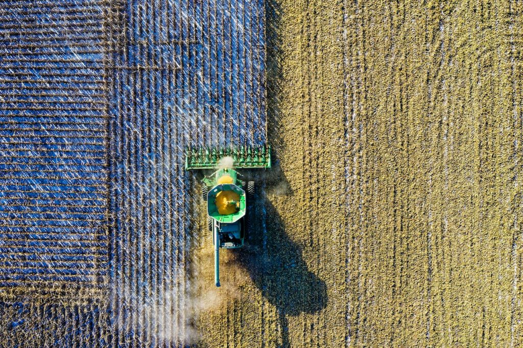
The agriculture industry is increasingly turning to drone technology for its efficiency and accuracy. Offering drone services to farmers can be a profitable business. You can help monitor crop health, track livestock, or even distribute seeds. With the right software, you can also provide detailed crop analysis, helping farmers to maximize their yields and minimize losses.
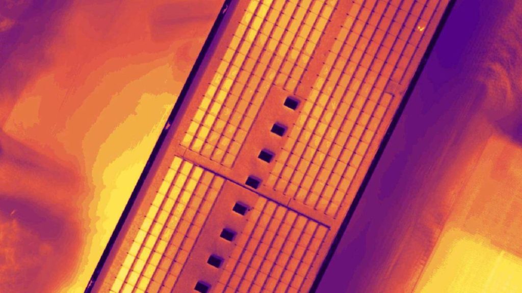
With a thermal camera, your drone can provide invaluable data for a variety of industries, and is a great way to earn money. These inspections can identify irregularities in temperature which can identify issues with buildings, solar panels, equipment, and even crops. Drone thermal sensors are becoming more inexpensive but require more training and comfortability for the mapping missions.
These types of inspections generally are quarterly or yearly, so it's a very repeatable process to bring in more income.
Placeholder for an image: A drone equipped with a thermal camera flying over a forested area for a search and rescue mission.
Search and rescue operations may not be a consistent income source. However, they can lead to contracts with local authorities or rescue organizations. Drones can cover large areas quickly and can be equipped with thermal imaging to find lost or missing persons. It's a way to make money with your drone while providing an essential service to your community.
These are just a few of the many ways to make money with drones. The possibilities are as limitless as the sky itself! Whether you're capturing the perfect wedding video, aiding in a rescue mission, or helping a farmer maximize crop yields, your drone is more than a hobby—it's a tool that can provide valuable services to a variety of industries and help make money.
Remember, while these opportunities are exciting, they also come with a responsibility to operate your drone safely and ethically. Always follow local regulations and respect privacy laws.
Ready to take your drone piloting to new heights? Get out there and explore these exciting opportunities!
Placeholder for a call-to-action image: An image encouraging readers to share their drone photos or videos with a particular hashtag on Instagram.
What's your next drone venture going to be? Let us know in the comments section below!
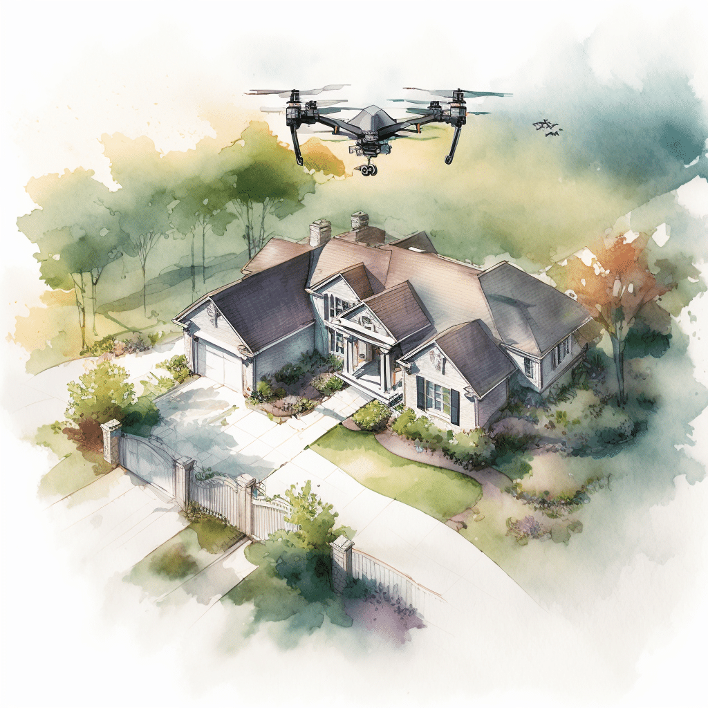
Drones have transformed the way we capture images and videos, especially in the real estate industry. If you're a drone pilot with a Part 107 certification, you have the unique opportunity to turn your passion into a profitable side hustle with drone real estate photography. In this comprehensive guide, we'll explore what it entails and outline the steps to build a successful business around it.
Drone real estate photography is the practice of capturing aerial images and videos of properties using drones. These images and videos provide potential buyers with a unique perspective, showcasing the property's layout, features, and surrounding areas. By offering aerial real estate photography, you'll help real estate agents, homeowners, and developers create captivating marketing materials that can enhance property listings and attract more buyers.
Before diving into the business aspects, let's explore the benefits of drone real estate photography, which will give you a better understanding of why it's such a sought-after service.
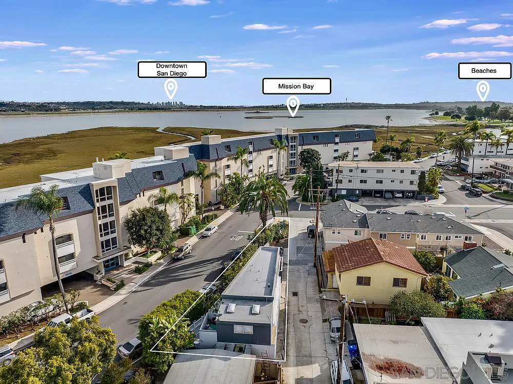
Aerial real estate photography offers a bird's-eye view of properties, giving potential buyers a better understanding of the property's layout, size, and features. This unique perspective can be a game-changer in the competitive real estate market. Many prospective buyers research houses online on websites like Zillow, Realtor.com, and Redfin. Having aerial photos of a property can give buyers a better perspective of the neighborhood and other unique features.
Compared to traditional aerial photography methods, such as hiring helicopters or planes, drone real estate photography is more affordable and accessible. This cost-effectiveness makes it an attractive option for real estate agents and property owners.
Drones can quickly capture high-quality images and videos, reducing the time it takes to produce marketing materials for properties. This allows real estate agents to list properties faster and streamline their marketing efforts. A typical turn around can be a few days to a week from hiring a drone pilot, to capturing the aerial photos, to editing and delivery.
Now that you understand the benefits of drone real estate photography, let's delve into the steps required to start a successful business.
Before launching your drone real estate photography business, it's crucial to research your local market. Identify your target client, such as real estate agents or property developers. Residential real estate agents assemble the marketing material for selling single family homes. Commercial real estate agents focus on commercial properties and developments. Focusing on a single type of real estate (residential vs. commercial) is important as you pursue your business. Analyze your competition and identify any gaps in their services that you can fill. This research typically includes reviewing real estate listings and noting trends with the types of aerial images and editing techniques that are used. In some markets, the use of aerial photography is included on every residential property listing above a certain price point. In other markets, aerial photos may not be used at all. This will help you understand your market's needs and tailor your offerings accordingly.
A solid business plan is the foundation of any successful venture. Outline your goals, target audience, pricing structure, and marketing strategies. Consider offering various drone real estate photography pricing services to accommodate different budgets and property types. These services can include aerial photos, editing services, aerial video, or even 360 degree panoramas.
Focusing on a specific niche within drone real estate photography can help you stand out from the competition. This could include residential, commercial, or luxury properties. By specializing in a particular niche, you can better cater to your target client's needs and establish yourself as an expert in that area.
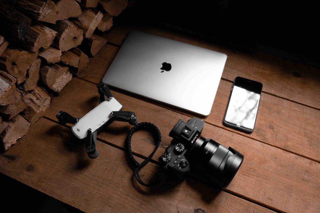
To deliver professional results, invest in reliable equipment, such as a high-quality drone, camera, extra batteries, and necessary accessories. Additionally, invest in image editing software to enhance your photos and make them stand out.
Generally, the best drone for real estate photography is the one you already have.
As a drone pilot, you'll need to have your Part 107 certification to operate commercially. Additionally, check your local regulations for any other permits or licenses required for drone real estate photography. It's also wise to obtain drone insurance to protect your business and your clients in case of accidents or damage.

Before approaching potential clients, create a compelling portfolio that demonstrates your drone real estate photography skills. Include a variety of property types, such as residential, commercial, and luxury properties. A well-rounded portfolio will showcase your versatility and expertise, making it easier to attract clients.
Drone real estate photography pricing can vary based on factors like property size, location, and the level of editing required. Research your competition's pricing and develop a strategy that's competitive yet profitable. Offer different pricing packages based on the services provided, such as basic, premium, and luxury packages.
Effective marketing is essential for growing your drone real estate photography business. Utilize various marketing channels, including social media, local advertising, and online real estate forums. Network with local real estate agents, property managers, and developers to build relationships and generate referrals. There are many types of drone real estate marketing outreach methods that you can implement.
Exceptional customer service is crucial for building a successful drone real estate photography business. Be responsive, punctual, and professional in all your interactions. Go above and beyond to exceed client expectations, and don't forget to ask for referrals and testimonials to help grow your business.
As a drone real estate photography professional, it's vital to stay updated on the latest industry trends, technology, and regulations. Regularly research new drone models, camera equipment, and editing techniques to ensure you're offering the best services possible. In addition, keep up with FAA regulations to ensure you're always operating within the law.
As your business grows, consider expanding your services to increase revenue and diversify your offerings. Here are some ideas on how to make money with drones:
Offer aerial mapping and 3D modeling services to create detailed property models for architects, urban planners, and construction companies.
Provide professional video editing and production services to create captivating property tour videos for real estate agents and developers.
Perform drone inspections for roof and building assessments, allowing property owners and managers to identify potential issues without the need for costly and time-consuming manual inspections. This can be a great way to expand into a high-volume and lucrative industry. We've detailed getting your first drone roof inspection jobs in an article showing how a pilot earned $450 in a single afternoon.
Launching a drone real estate photography business can be a rewarding and profitable side hustle for Part 107 certified drone pilots. By following this comprehensive guide, you'll be well on your way to establishing a successful enterprise in this thriving industry.
Remember, success in this business requires dedication, professionalism, and a commitment to providing exceptional service. As you grow your business, continue to refine your skills, invest in the latest equipment, and adapt to industry trends to stay ahead of the competition.
Ready to turn your passion for drone photography into a profitable business? Get started today by following the steps outlined in this guide, and soon you'll be capturing breathtaking aerial shots while growing a successful business in this exciting industry.
If you found this article helpful, please share it with your fellow drone pilots and aspiring drone real estate photographers. And if you have any questions or tips to share, feel free to leave a comment below. We'd love to hear about your experiences in the drone real estate photography business.
In this blog post, we will discuss the different types of outreach to build your aerial photography business and succeed at drone real estate marketing. We will cover cold outreach, leveraging your network (warm leads), social media, developing partnerships, and establishing authority in the industry.
Cold outreach involves contacting potential agents who don't know you through email, calls, or in-person visits. This powerful and inexpensive prospecting method can help you build your first few clients and overcome the common resistance of not knowing anyone in the industry.
Cold outreach can be intimidating, but it becomes easier with practice. It's essential to reframe any negative beliefs and focus on the value you're providing to the agents. Real estate agents want to be found and grow their network. Finding their contact info and reaching out to them either through a cold call or a cold email can be a win-win scenario for you and the agent. The aerial photography you provide could help them sell their listings faster, helping them earn their commissions quicker.
In terms of cold outreach, I've had extreme success with it. Everything from small drone real estate jobs all the way to $14,000 mapping jobs just from a cold call. Remember, the worst someone can say is no.
Setting a daily or weekly quota, conducting research, and tracking your outreach can help you stay consistent and build your cold outreach muscle.
Cold outreach is amazing and a little scary when you realize how accessible things are. Cold outreach is a muscle that gets stronger.
Decide how you're going to conduct your research. Most real estate agent contact information is readily available online at sites like Zillow or Realtor.com. Phone calls at the same time each day also makes it very easy and almost non-negotiable for you, it becomes just a habit of something that you do.
Here's a big hack when cold calling:
Pull out your phone, type the phone number of your next lead and hit call before you can convince yourself otherwise. It will force you to not overthink or allow you to talk yourself out of it. Just dial and have a rough idea of what you will say to the agent. If you treat this like a big experiment without any pressure, it will help you have fun with it.
-DroneTribe

Leveraging your network involves reaching out to people you already know or have a connection with. If you know a real estate agent, start by talking to them. Typically framing the conversation such that you are thinking of starting a drone real estate photography business and if you could learn more about the industry. This is a low pressure way to get started and learn more about the industry.
Ask friends and family who recently bought or sold a house for introductions to their agents. For this type of outreach, I typically call the agent and say "Hi [Agent], you were the real estate agent for my friend [Friend's Name] and he mentioned he had a great experience with you. I'm starting a drone real estate photography business, do you have a couple minutes? I wanted to learn more about the industry." It's as simple as that.
Warm leads are an easy way to learn and grow your business, as people prefer working with someone they know and trust. Be genuine and personable when talking to these potential clients.
Becoming an industry leader can significantly impact your drone real estate business. Here are some ways to establish authority in the field:
Remember to be friendly, confident, and passionate about drones when talking to people. Your enthusiasm will be contagious and help you create lasting connections. A great tone to take is educating vs. selling. No one wants to be sold to!
A drone real estate marketing plan should include some amount of social media exposure! It's a free method to build content around your business. Each platform has a slightly different way to approach, from a focus on photos to video (short form and long form). Below is a list of different social media ways to utilize them:
Social media can be a huge pipeline of new clients if used diligently!
Partnering with businesses that have a massive deal flow can significantly benefit your drone real estate business. Consider the following partnerships:
By partnering with them, you can offer your drone services as an add-on to their existing packages. This mutually beneficial relationship can help both parties grow their businesses.

To get started, spend 15 minutes brainstorming potential partnerships and research local real estate photographers. Reach out to several about partnering through emails or phone calls.
Building a business in drone real estate involves various types of marketing outreach, including cold outreach, warm leads, establishing authority, social media, and developing partnerships. By utilizing these methods, you can create a thriving business and help agents sell homes more effectively.
Remember to be genuine, passionate, and confident in your interactions with potential clients and partners. With persistence and dedication, you can overcome any challenges and succeed in the drone real estate industry.
Over the past several years the process for getting airspace authorizations (approval to perform drone operations in controlled airspace) has gotten easier and easier.
Except directly at airports. That has remained a fairly difficult task to get airspace authorizations, and then even more difficult to perform drone operations.
Before we dive into '0' grids, here's a quick refresher on the state of airspace authorizations today.
The LAANC (Low Altitude Authorization and Notification Capability) is an automated system that allows for Part 107 (and now recreational drone operators) the ability to quickly request and get approvals to operate up to specific altitudes.
The altitudes are specified by the FAA UAS Facility Maps and vary between 0 and 400 feet in controlled airspace. These altitudes are the ceilings in which an operator can fly in with a LAANC automated authorization.
In layman's terms: the FAA has created 1 mile x 1 mile grids in all of the controlled airspace and set an altitude in which you can receive an automatic authorization thru LAANC.
Most of the controlled airspaces in the United States now utilize LAANC (here's a list of them all).
Here's an example of what the LAANC grids look like at the Boise Air Terminal (KBOI) in Idaho. You'll also notice that those grid boxes around the airport are all green. This means it's a LAANC supported airport.
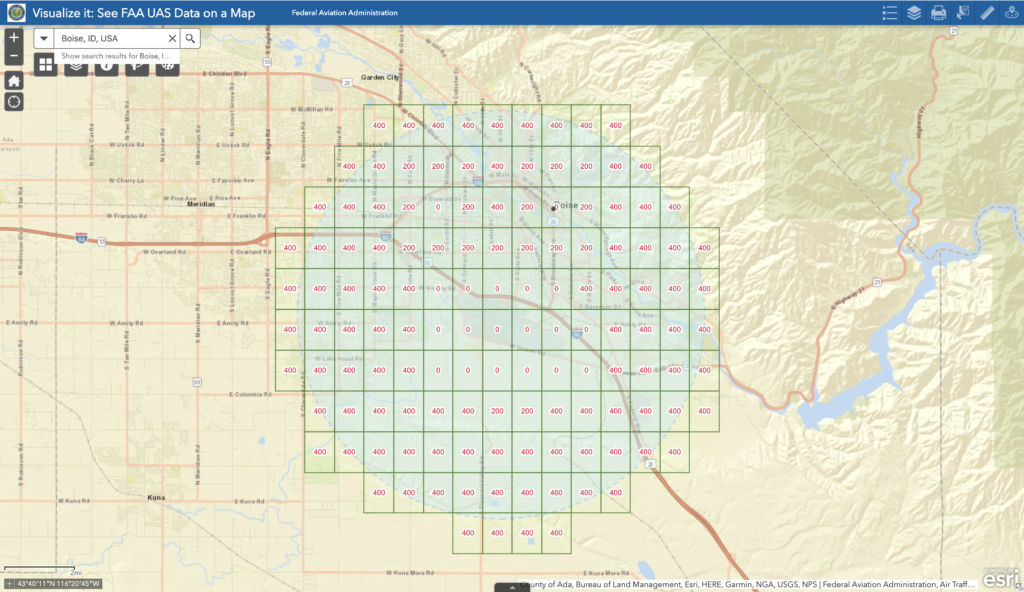
KBOI airspace facility map grid. The grid boxes are green which means it's a LAANC approved airport.
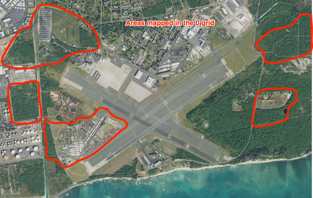
You'll see more '0' grids over the runways, while higher grid ceiling heights of 200 and 400 feet more than 1 mile away.
You can easily request to fly up to to those altitudes with a LAANC provider like Airmap, Skyward, or Kittyhawk. Additionally, you can request to fly above those ceiling numbers (such as to map an area at 400 ft while in a 200 ft grid), however there will be a manual review process and it will not be automatic.
There are airports that do not support LAANC yet, and those are in red. You can see this example here at the Idaho Regional Falls airport (KIDA):
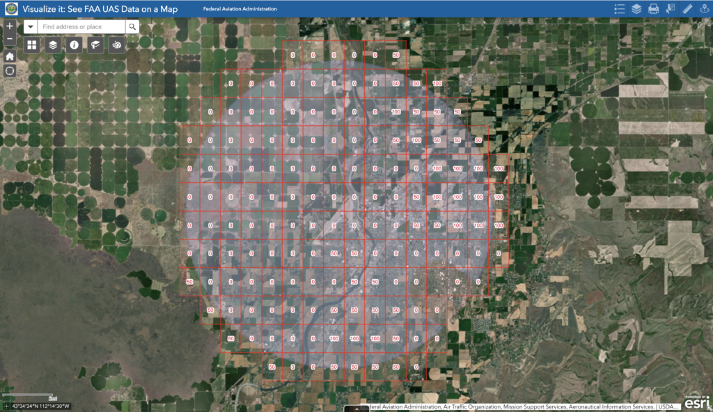
KIDA airspace facility map grid. The grid boxes are red which means it's NOT a LAANC approved airport. You will need to get authorization via the FAA DroneZone to perform any operations.
You're unable to use LAANC to get any authorization at this airspace. Most military airports do not allow for these types of automated authorizations, and require a manual process.
I've used LAANC countless times, but as you can imagine, if you want to fly above those altitude ceilings? How would you go about that?
The FAA DroneZone was the original tool the FAA used for airspace authorization requests before LAANC was rolled out. It's still used for non LAANC airports.
It's with FAA DroneZone that you can also make specific requests to operate above these grid limits. This is how I've gotten my authorizations approved to operate at 400 ft AGL in a '0' grid (adjacent to the runway).
This article is to let you know it's possible to operate in a '0' grid legally, not necessarily provide the exact details on how to do so.
The overall process took around 30 days from my first application to when I was approved to operate.
A recent client owns a lot of land adjacent to a Class D airspace here on Oahu (Hawaii) and needed updated imagery maps. It just so happens that these areas are on or near approach paths for the airspace.
These areas are also large (80-150 acres) with vegetation, so it would be very difficult to map at lower altitudes (the lower the altitude, the more flights it would require).
I determined that operating at 400 ft AGL for the mapping missions was optimial for the imagery, as well as reducing the overall amount of time in the air.
The lower altitude you map at, the higher resolution the imagery, but the longer it would take. Even mapping the same project area at 300 ft instead of 400 ft could be the difference of 6 flights (each at 20 min).
It's much easier to communicate with ATC (air traffic control) that you only have two 20 min flights, instead of eight.
So with the project areas defined, and the desired flight altitudes set, it was time to request for the authorization via FAA DroneZone.
The airport in question was not LAANC approved, so I had to apply via the FAA DroneZone regardless of what altitude I was requesting for.
'I did speak with the FAA recently at a conference and their representative suggested for all '0' grid operations, to apply via the FAA DroneZone (even at LAANC authorized airports).
In my description of the operation, I specified the altitude, coordinates, and approximate duration of the operation. Additionally I included specifics about boundaries of the project area.
With FAA DroneZone submittals, it first goes to the regional FAA representative to review and then submit on to the local ATC of that airspace.
Surprisingly, the local ATC called me to have me come in and explain in more details what the operation entailed. Once I did that and we worked out a plan together, they approved the authorization request.
2 weeks later I was flying at 400 ft adjacent to one of their runways performing a mapping mission. By adjacent literally alongside.
Since then, I've performed 5 other operations at 400 ft AGL, all near the airport (and all within the 0 grid).
Each day I perform operations, I call the tower 30 minutes before hand, and again 5 minutes before each operation. I communicate with the tower with a two way radio and am listening to all the air traffic communicate over the CTAF frequency.
It's exhilarating, but ultimately just a part of the job.
In September 2017, one of general contractor clients who I’d worked with closely in the past, had a project in the initial setup phase.
In this article I’m going to dive a little deep on some of the more technical aspects of what I was planning to deliver to the client, then talk a bit more about different challenges I faced.
They needed a highly accurate topographic map of the job site to begin planning their construction. This meant using ground control points (GCPs).
What are GCPs? Think of them as marked points on the ground that have a well known geographic location.
Typically, a professional surveyor will capture the coordinates of these marked points, however technology is advancing and there is now the ability for mobile GCPs like AeroPoints.
Why are GCPs used to make topographic maps more accurate?
Here’s the basics: when creating 3D topographic maps using photogrammetry, you can create maps with high relative accuracy. Using GCPs allows you to create maps with high absolute accuracy.
Relative accuracy = points in relation to each other
Absolute accuracy = points in relation to the real world elevation
Without the use of GCPs, you just have an accurate map relative to itself, floating in space. Using GCPs, you are able to bring that map to have high level of absolute accuracy (think about pulling that map down from floating in space, to the surface of actual terrain you are mapping).
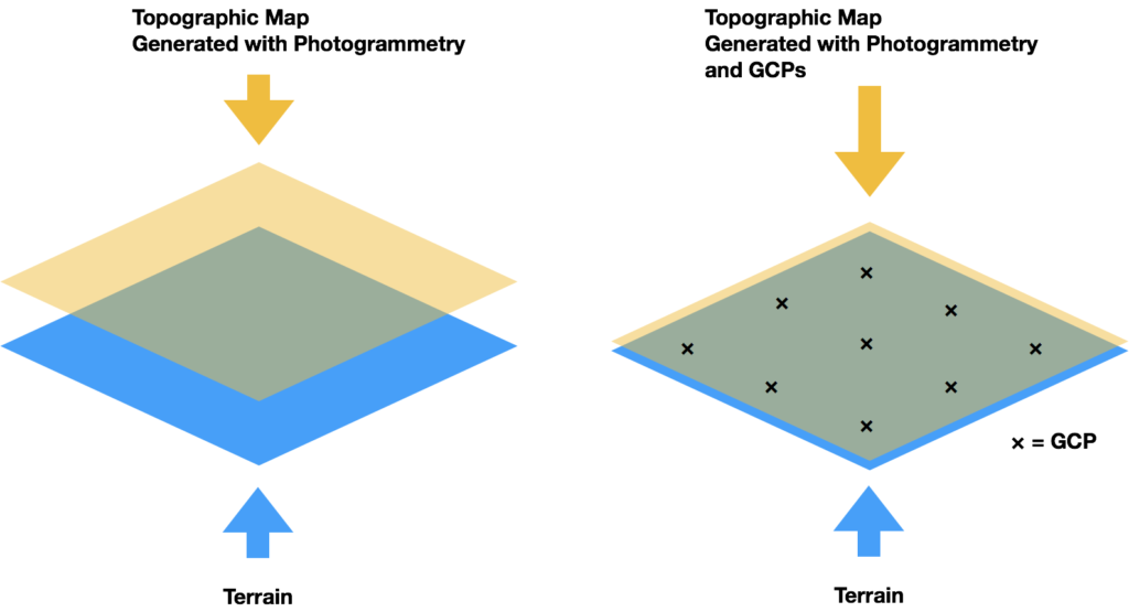
Our plan for this jobsite was to have the general contractor provide the coordinates of 10 GCPs. I would then include these coordinates when creating the final 3D topographic point cloud using photogrammetry.
Additionally, after analyzing the airspace, I identified that the jobsite was within Class B Airspace, and was within an FAA grid map of 100 ft AGL.
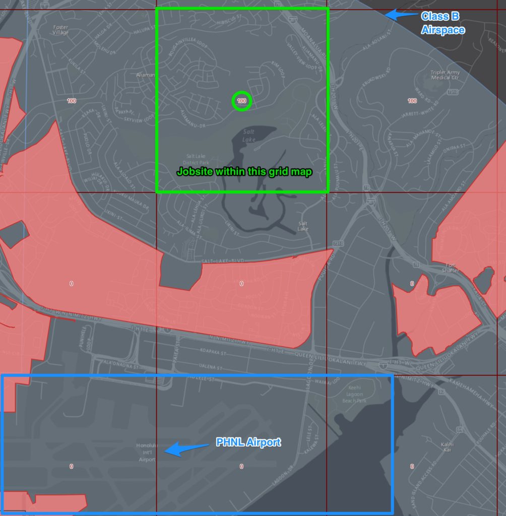
Instantly I realized that:
I had not applied for an authorization in Class B airspace before, so I had no idea how long it would take. Because I would be flying at or below 100 ft AGL, I called air traffic control to determine if I could get verbal authorization, or if I still need to make the request thru the FAA website.
Answer: I needed to apply online via the FAA website. This could take 90 days for getting the authorization, which would potentially delay the operation 3 months.
All this information in hand, I proposed a bid to the client. It totaled $1,100 for 2 hours of on-site work. It also included the cost for processing the 3D point clouds, acquiring the Class B airspace, and having an additional visual observer on-site.
Several days later, I spoke with the client and we discussed the bid. The price was not an issue, however the timing was. They needed this done in the next week, not 3 months from then.
The client agreed that performing the operation legally was of upmost importance, so they decided to stick with traditional methods (boots on the ground and surveying equipment) to complete the job.
And there lies my $1,100 mistake.
If I had been pre-authorized for this Class B airspace, I would have been able to legally complete the job.
Almost immediately after realizing this, I applied for authorizations in ALL airspaces on my island. For you this may mean applying for authorizations for all airspaces within a 60 minute drive.
Having these pre-authorizations is a huge differentiating factor for your own operations and potential competitors.
In November 2017, I was connected to the owner of a local roofing company focusing on residential and commercial work.
I am always putting myself out there and introducing people to myself and my drone service business.
What I’ve learned in the past year is that our job as commercial drone operators is 80% education for clients as to how drones can potentially be used within their businesses. In this case, we identified an area that is highly time intensive for their roofing estimators.
Here’s an example to better illustrate this scenario:
There’s a part of this entire process that causes a big hold up: when the roofing company sends their estimator on site.
They have to climb to the top of the roof and walk it, taking photos and measurements. Then wait several days for claims adjuster to do the same.
This sounds highly inefficient, right?
Agreed.
So that’s where drones come into the picture.
What if an FAA-Certified Drone Pilot can come on-site, fly their drone and take specific aerial photos, and later have a software that identifies all the required deliverables in a report that both the roofing company and claims adjuster agree upon?
Sounds like using a drone will save time, money, and is safer (no one has to climb 3 story roofs anymore).
That’s where I come in.
This local roofing company hired me to test a new roofing report software on three of their client’s roofs.
The roofing estimator contacted me and sent me addresses of potential job sites to inspect, and I checked the airspace around each. We decided on two in the same neighborhood, and another on another part of the island, all in Class G airspace.
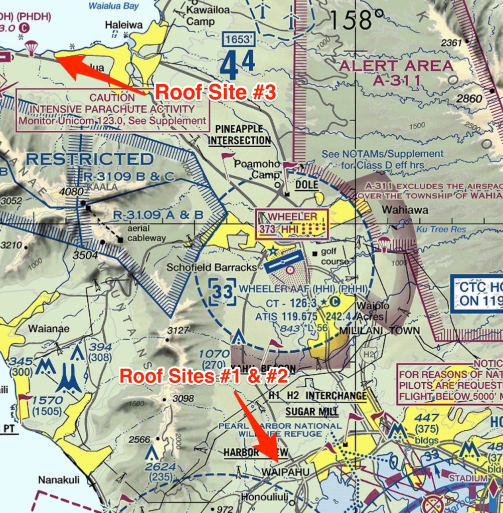
We scheduled the time and day, and I ensured the drone I was using (Phantom 4) was full charged, had current firmware, and passed my own visual inspection.
On the morning of my operations, I checked the weather, visibility, and if there were any Temporary Flight Restrictions in the area. SkyVector is a great resource for this.
NOTE: It just so happens that Air Force One was stopping off at PHNL airport in Honolulu two days later, which enacted a 30 mile no fly radius. Luckily, this did not interfere with the operation.
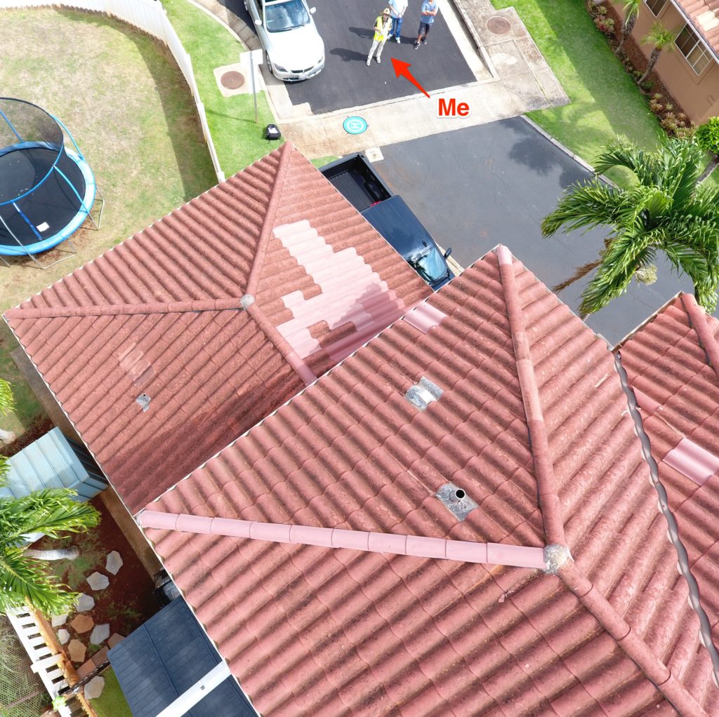
Upon arriving on-site, I performed my pre-flight checklist, which involves walking around the site among other things.
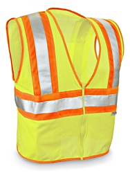
One big note for each job - I try to convey a level of professionalism, which means I’m wearing steel toed boots, pants, a collared shirt, and a fluorescent safety vest.
The aerial photos that the software required were a mix of orbits, close-ups, and a zig-zag pattern of vertical images (think a lawnmower pattern).
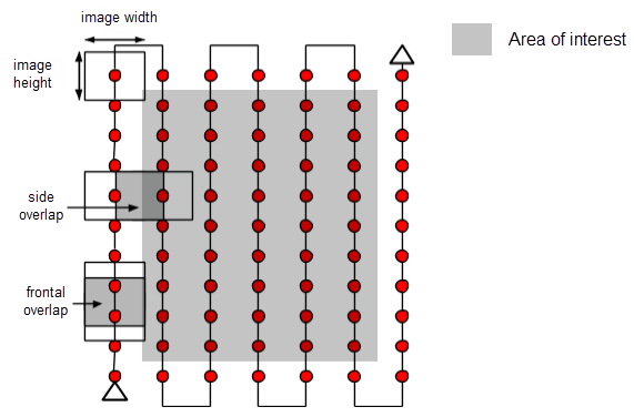
Picture from Pix4D
Successful delivery of the images just required access to a Dropbox account and uploading all images.
With 24 hours, the software company had generated special reports for each job site, highlighting damaged areas that required repairs, as well as measurements and surface area of the roofs.
Simple.
For these flights, I earned $150 per site. Each site required about 1 battery (25-28 min of flight time). In total including driving, a four hour afternoon of work earned me $450.
Not too bad!
Unfortunately due to NDA agreements, I’m unable to disclose the specific software company were testing. However, there are some great options when you search for “drone roofing inspection software” 🙂
There are so many different types of opportunities utilizing aerial technology. This roofing company wanted an experienced drone operator to not only fly and capture images, but to test a new software. Eventually, this may lead to an opportunity to help setup an internal drone operation for the roofing company (think consulting).
I had no idea that a lot of roofing companies work was generated from claims adjusters and the relationship they have. Just goes to show you the importance of diving deep into industries and understanding all the inefficient existing processes that drones can replace.
Earning a great side income with drones if very do-able.
If you're just getting started out and are looking to learn how you can start your own drone business, checkout our free webclass: Drone Business Webinar.