In September 2017, one of general contractor clients who I’d worked with closely in the past, had a project in the initial setup phase.
In this article I’m going to dive a little deep on some of the more technical aspects of what I was planning to deliver to the client, then talk a bit more about different challenges I faced.
They needed a highly accurate topographic map of the job site to begin planning their construction. This meant using ground control points (GCPs).
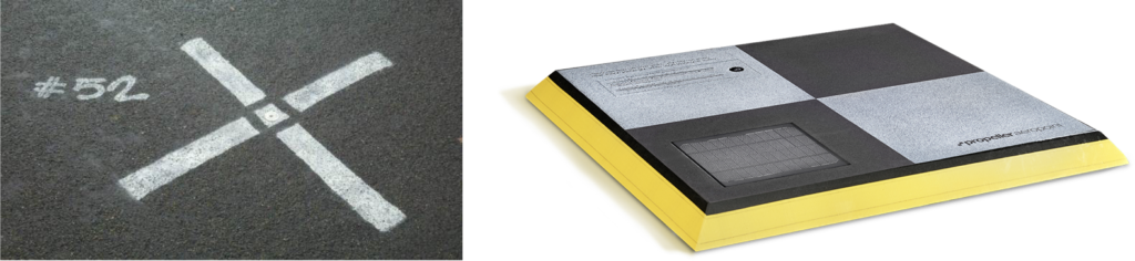
What are GCPs? Think of them as marked points on the ground that have a well known geographic location.
Typically, a professional surveyor will capture the coordinates of these marked points, however technology is advancing and there is now the ability for mobile GCPs like AeroPoints.
Why are GCPs used to make topographic maps more accurate?
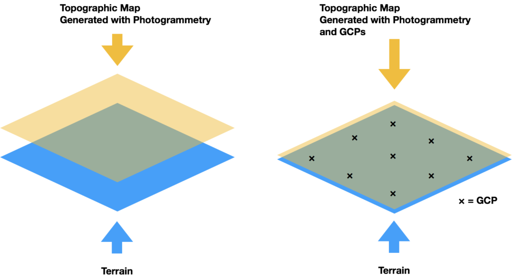
Here’s the basics: when creating 3D topographic maps using photogrammetry, you can create maps with high relative accuracy. Using GCPs allows you to create maps with high absolute accuracy.
Relative accuracy = points in relation to each other
Absolute accuracy = points in relation to the real world elevation
Without the use of GCPs, you just have an accurate map relative to itself, floating in space. Using GCPs, you are able to bring that map to have high level of absolute accuracy (think about pulling that map down from floating in space, to the surface of actual terrain you are mapping).
Our plan for this jobsite was to have the general contractor provide the coordinates of 10 GCPs. I would then include these coordinates when creating the final 3D topographic point cloud using photogrammetry.
Additionally, after analyzing the airspace, I identified that the jobsite was within Class B Airspace, and was within an FAA grid map of 100 ft AGL.
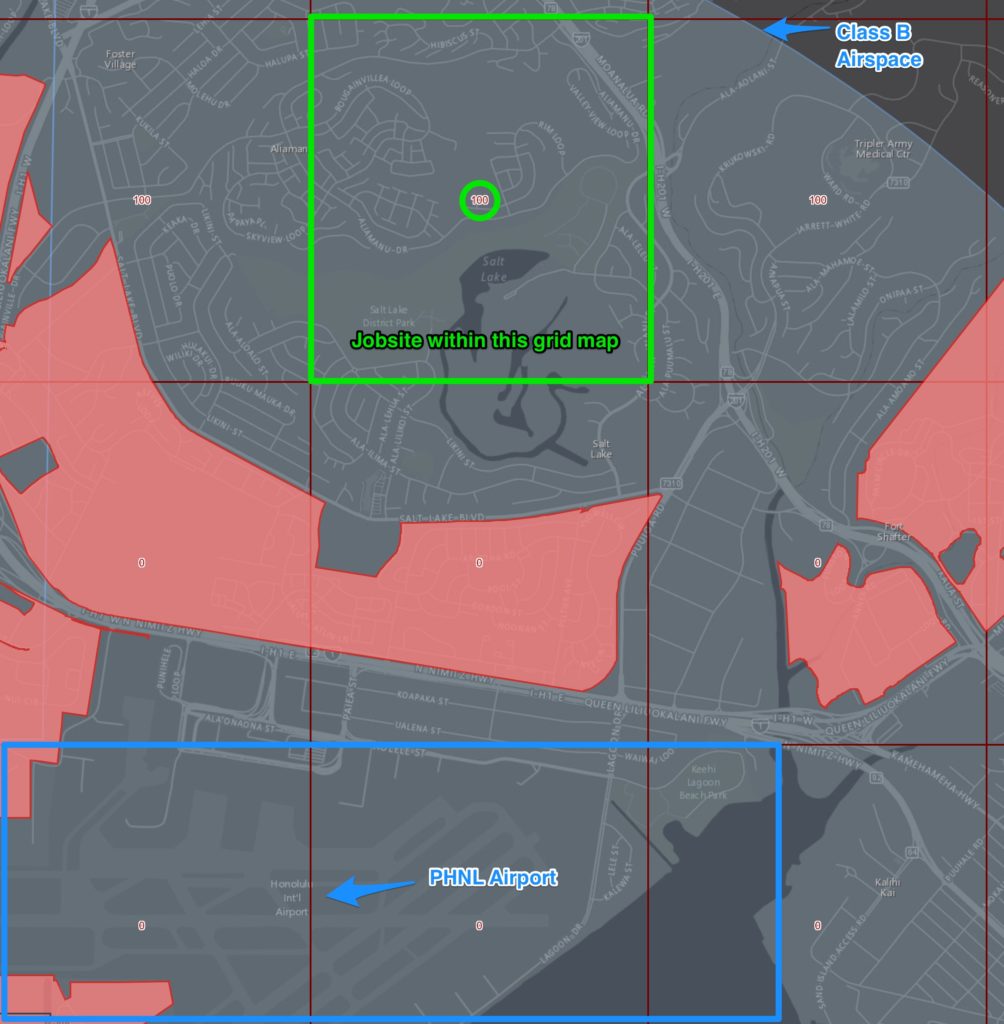
Instantly I realized that:
- I would need Class B Airspace Authorization
- If I keep the operation below 100 ft AGL, there was a good chance the authorization would be issued faster
I had not applied for an authorization in Class B airspace before, so I had no idea how long it would take. Because I would be flying at or below 100 ft AGL, I called air traffic control to determine if I could get verbal authorization, or if I still need to make the request thru the FAA website.
Answer: I needed to apply online via the FAA website. This could take 90 days for getting the authorization, which would potentially delay the operation 3 months.
All this information in hand, I proposed a bid to the client. It totaled $1,100 for 2 hours of on-site work. It also included the cost for processing the 3D point clouds, acquiring the Class B airspace, and having an additional visual observer on-site.
Several days later, I spoke with the client and we discussed the bid. The price was not an issue, however the timing was. They needed this done in the next week, not 3 months from then.
The client agreed that performing the operation legally was of upmost importance, so they decided to stick with traditional methods (boots on the ground and surveying equipment) to complete the job.
And there lies my $1,100 mistake.
If I had been pre-authorized for this Class B airspace, I would have been able to legally complete the job.
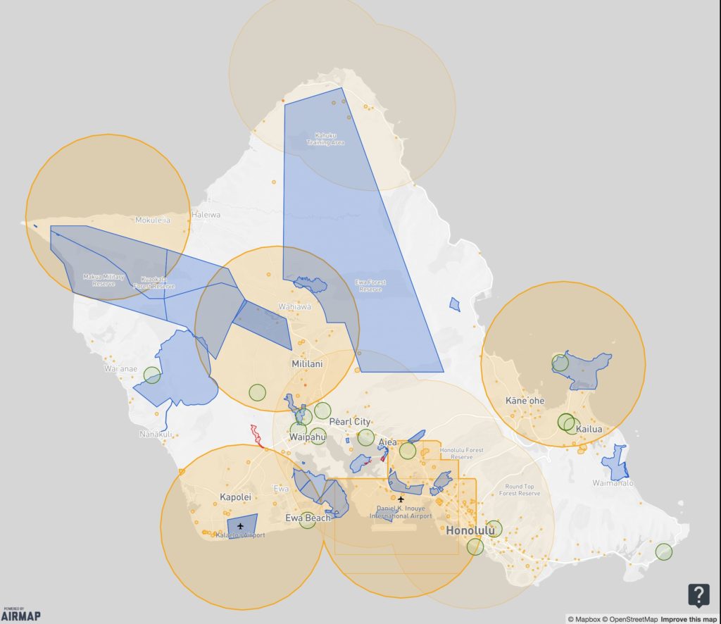
Almost immediately after realizing this, I applied for authorizations in ALL airspaces on my island. For you this may mean applying for authorizations for all airspaces within a 60 minute drive.
Having these pre-authorizations is a huge differentiating factor for your own operations and potential competitors.
Lessons Learned:
- Get pre-authorization to operate within airspaces where you will be performing commercial operations
- There’s so many different opportunities out there for FAA-Certified Drone Pilots. Just get started and you’ll learn along the way.